
Hydrologic Engineering Center’s Hydrologic Modeling System (HEC-HMS) can now Import Gridded Rainfall Data Globally
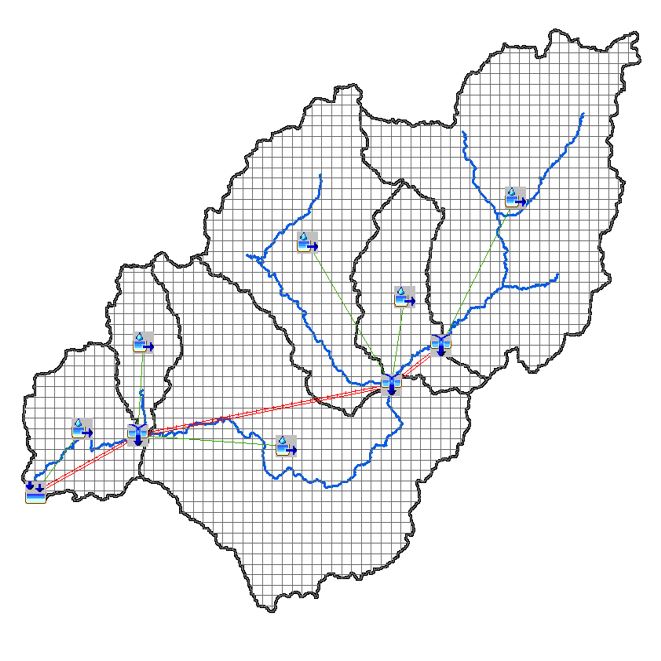
Water-related software from the U.S. Army Corps of Engineers’ Hydrologic Engineering Center (HEC) is very popular internationally because it is high quality, is well documented, comes with training, is supported, and is freely downloadable. HEC’s hydrologic modeling system (HEC-HMS) is no exception. However, one limitation has been that it has not been possible to utilize the gridded precipitation option for areas outside of the United States due to limitations in how gridded data was stored in the model.
 This is no longer a limitation. HEC, in collaboration with ICIWaRM, the University of California, Irvine’s Center for Hydrometeorology and Remote Sensing (CHRS), and UNESCO-IHP’s drylands water resources program G-WADI, has now modified their grid data libraries to include storage of gridded data in the Universal Transverse Mercator (UTM) spatial reference system.
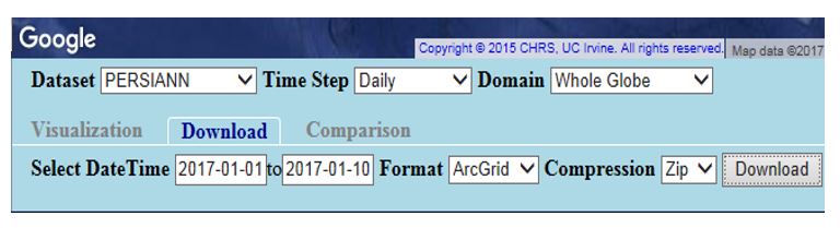
Gridded precipitation can come from different sources, but in developing countries with limited ground-based data a common source is satellite derived precipitation estimates. This would include CHRS’s PERSIANN family of real-time and historical products (PERSIANN-CCS, PERSIANN-CDR, PERSIANN-Connect, iRain, RainSphere and others). HEC has created an online, virtual workshop that shows how to prepare an HMS model to run with a variety of sources of precipitation data – point rainfall, grid-based interpolation, and satellite precipitation. The workshop also introduces a number of software applications.
 The workshop materials are available from HEC at http://www.hec.usace.army.mil/training/materials.aspx.